- Title: Coastal Flooding Hazard in Florida: Evaluating the Contribution of Local Subsidence
- Principal Investigators: Shimon Wdowinski
- Funding Amount: $327,227
- Funding Source: Florida Office of Insurance Regulation
- Timeline: 07/01/18–06/30/22
Over the past decade, several coastal communities in southeast Florida have experienced a significant increase in flooding frequency, which has caused disturbance to property, commerce, and overall quality of life. The increased flooding reflects the contribution of global, regional, and local processes that affect elevation difference between coastal communities and rising sea level.
In a recent project, funded by the state of Florida, we monitor coastal subsidence in southeast Florida using GPS and spaceborne radar observations, in order to evaluate the contribution of local subsidence to the increased coastal flooding hazard.
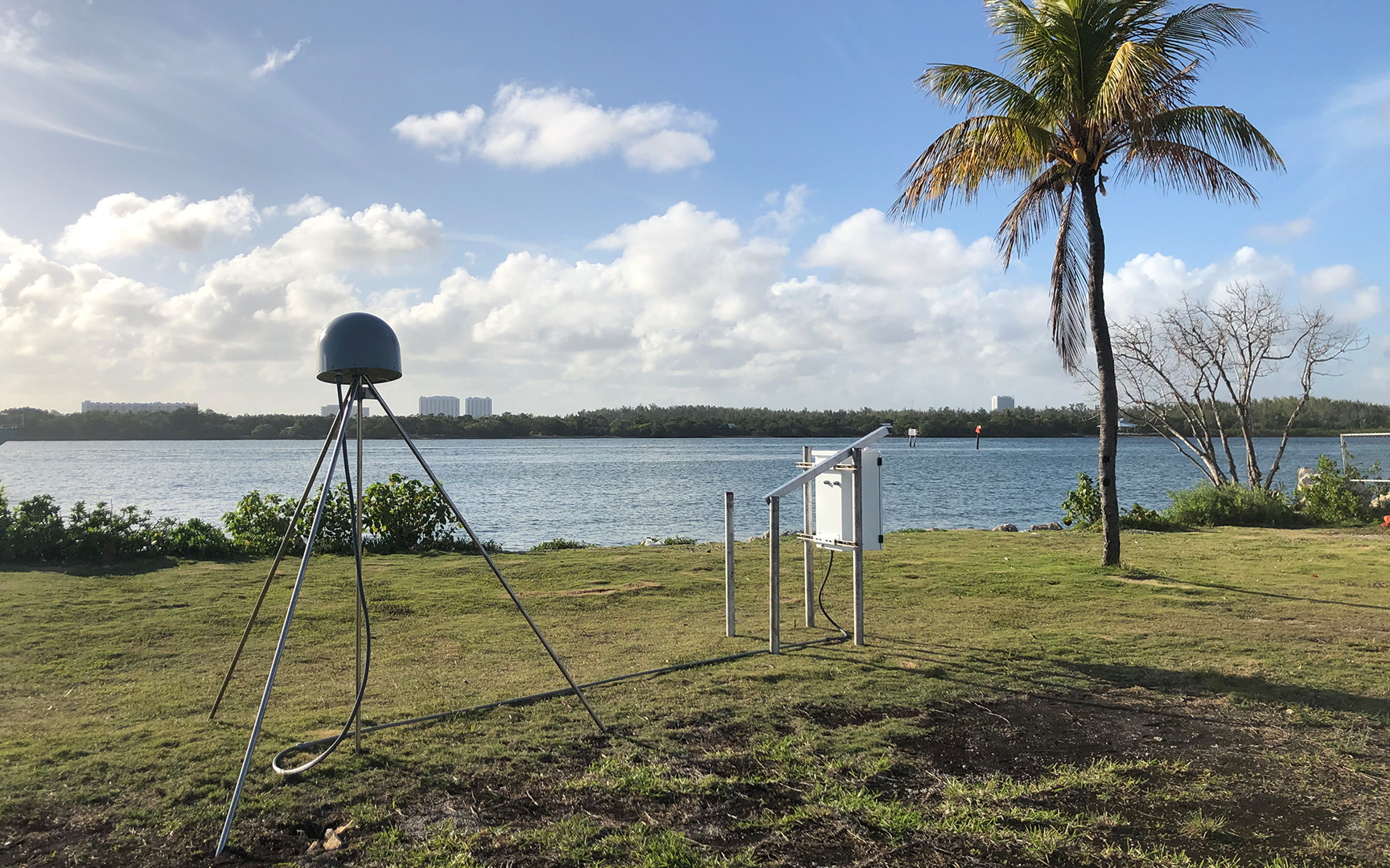
As part of the project, we constructed a network of four continuously operating GPS (cGPS) stations that monitor land subsidence with accuracies of millimeters per years (Figure 1). Each station is equipped with precise GPS antenna, a monument holding the antenna, solar panels, and cellular communication, and an explanation plaque (Figure2). The spaceborne radar observations enable the detection of building movements over wide areas, also with accuracy of millimeters per year.
Read the article about the study, published in Proceedings of the International Association of Hydrological Sciences.
Team
Principal Investigator
Shimon Wdowinski
Professor
305-348-6826
swdowins@fiu.edu
AHC5 388